When Dr. Benito A. Aligada, director of Philippine Institute of Volcanology and Seismology confirmed a earthquake of magnitude 7.4 struck offshore near Manay, Davao Oriental on Friday, October 10, 2025, the death toll rose to at least two and dozens of buildings showed serious damage.
Background on Seismic Activity in the Philippines
The archipelago sits on the Pacific Ring of Fire, where the Philippine Sea Plate collides with the Eurasian Plate. On average, the country records roughly 200 detectable quakes a year, most of them below magnitude 5.0. Yet history reminds us that the region can unleash powerful jolts without warning, as happened in 1990, 2013, and the more recent September 26, 2025, magnitude 6.9 earthquake that devastated Cebu and claimed 74 lives.
Immediate Impact and Damage
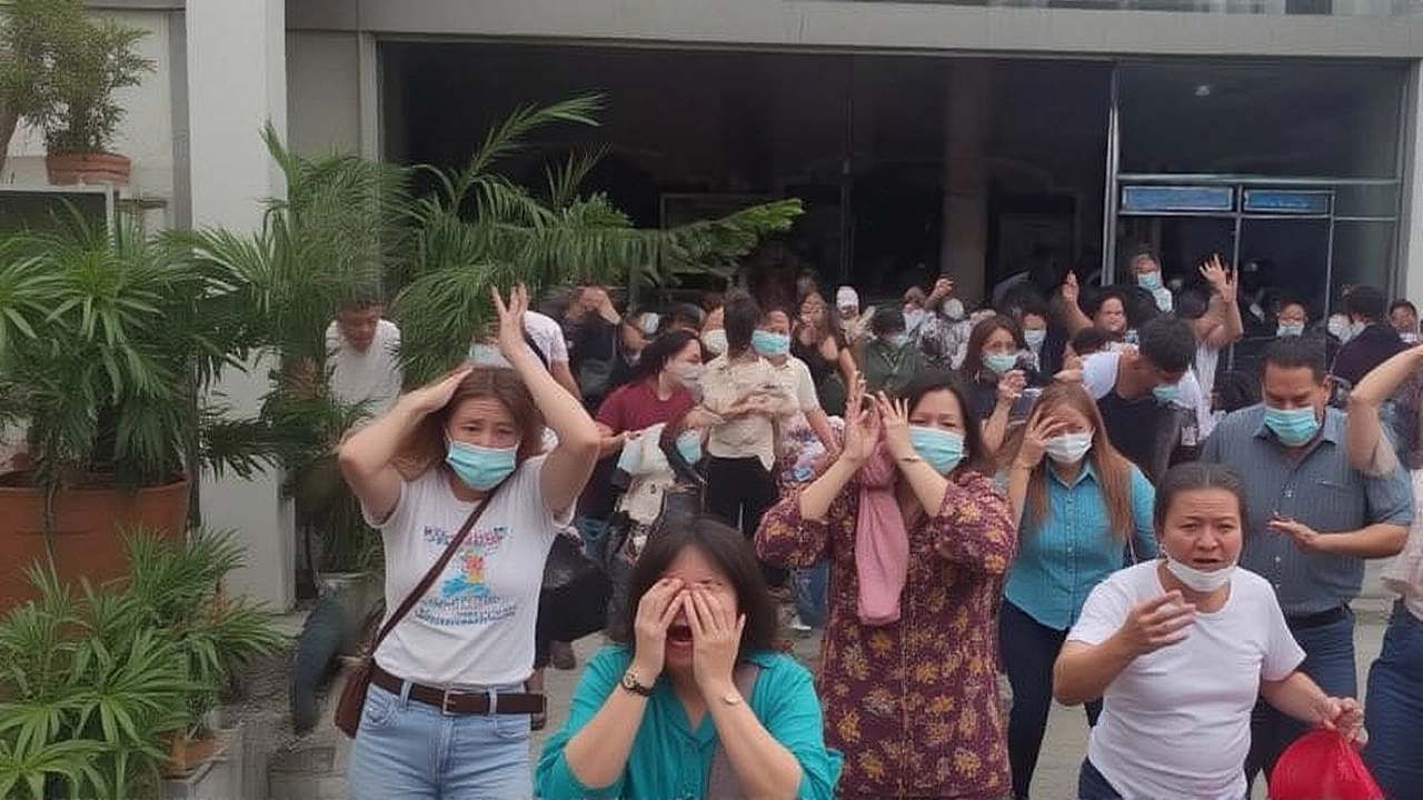
Structural damage was documented in several municipalities closest to the epicenter. In Panabo City, Davao del Norte, fire trucks swayed like giant pendulums as residents fled to open fields. Video shared on social media showed a fire engine rattling on its wheels, windows cracking, and a small crowd huddling behind a makeshift barricade.
Further north, Butuan City, Agusan del Norte officials reported crowds gathering in designated evacuation zones, fearing falling debris. "We saw people line up under the streetlights, holding hands, waiting for the shaking to stop," said local barangay captain Luis Ramos.
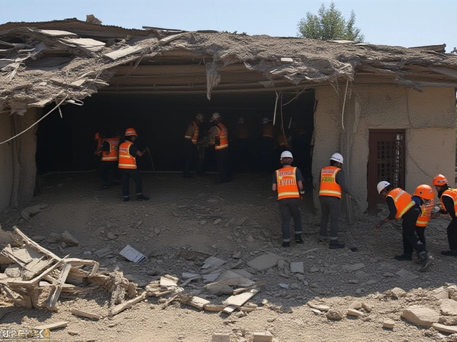
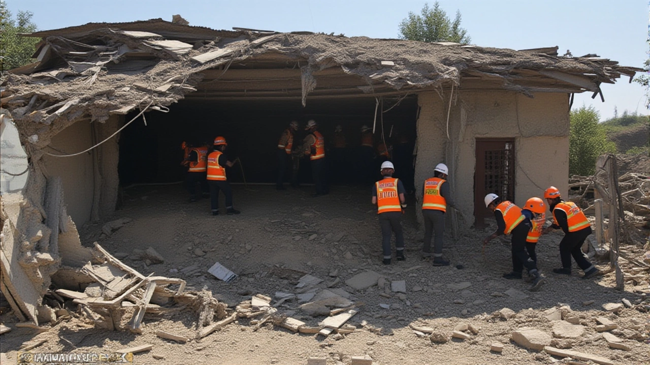
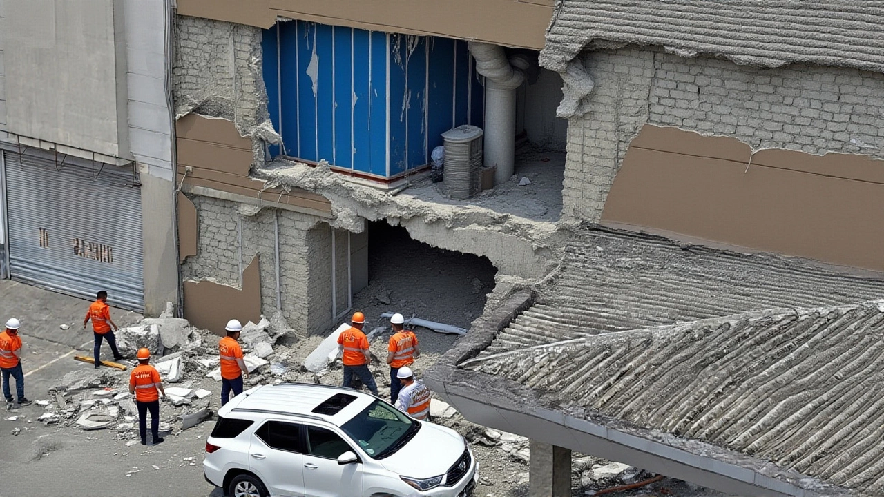
At least three public elementary schools in Manay and the Davao Oriental Provincial Hospital suffered roof and wall failures, prompting the Department of Education to suspend classes until safety inspections are complete.
- Two confirmed fatalities – a construction worker in Manay and a shopkeeper in Panabo.
- Over 30 injured, many with minor fractures.
- Damage to roads, bridges, and power lines affecting roughly 150,000 residents.
Government and Agency Response
The National Disaster Risk Reduction and Management Council (NDRRMC) immediately activated its emergency operations center. In a press briefing, NDRRMC spokesperson Carla Villanueva urged citizens to stay alert for aftershocks and to avoid damaged structures.
Simultaneously, Philippine Institute of Volcanology and Seismology issued a tsunami warning covering coastal municipalities within a 300‑kilometer radius, including Davao del Sur, Compostela Valley, and Surigao provinces. The alert was lifted after a few hours when monitoring showed no significant sea‑level rise.
Emergency response teams from the Office of Civil Defense, the Department of Public Works and Highways (DPWH), and local government units are now conducting damage assessments. Engineers are inspecting bridges along the Davao–Butuan corridor, while medical teams set up triage tents at the provincial hospital.
Aftershocks and Ongoing Risks
Experts warn that aftershocks could continue for weeks, some possibly reaching magnitude 5.5 or higher. Dr. Aligada explained, "The subduction zone beneath Mindanao can generate a cascade of tremors after a mainshock this size. Residents should expect strong shaking intermittently and secure heavy furniture now."
The NDRRMC has set up a 24‑hour hotline for damage reports and is distributing emergency kits to the most vulnerable barangays.
Comparison with the Recent Cebu Quake
Exactly two weeks earlier, the 6.9‑magnitude quake in Cebu killed 74 people and left thousands homeless. That disaster stretched national rescue resources thin, and the Davao Oriental response is being coordinated with lessons learned from Cebu: faster deployment of search‑and‑rescue dogs, pre‑positioned medical supplies, and clearer communication channels via social media.
While Cebu saw widespread building collapses, the Davao event's offshore epicenter spared many urban centers from total devastation. Still, the damage to schools and the hospital mirrors the vulnerabilities exposed in the central Visayas.
Future Preparedness and What’s Next
Authorities plan to conduct a comprehensive seismic risk assessment of the Davao Region over the next three months. The Department of Education will audit school structures, and the DPWH aims to retrofit critical bridges before the rainy season.
In a policy briefing, the Senate’s Committee on Disaster Management urged lawmakers to fast‑track amendments to the National Building Code, incorporating the latest seismic design standards. "We cannot afford another tragedy when we know the science,” said Senator Grace Padilla.
For now, residents are advised to keep emergency kits ready, stay tuned to PHIVOLCS and NDRRMC bulletins, and practice “Drop, Cover, and Hold On” drills daily.
Frequently Asked Questions
How many people were injured in the Davao Oriental quake?
Health officials reported over 30 injured, most with minor fractures or bruises. A few required hospitalization for head injuries, but none are in critical condition as of the latest update.
Did the tsunami warning affect coastal travel?
Ports in Davao del Sur and Surigao were temporarily closed while the warning was active. Once PHIVOLCS lifted the alert, ferry services resumed, though some vessels remain grounded for safety inspections.
What steps are being taken to repair damaged schools?
The Department of Education, together with the DPWH, has deployed engineers to assess structural integrity. Temporary classrooms made from prefabricated units will be set up within two weeks while permanent repairs are planned.
Will there be more aftershocks in the coming weeks?
Seismologists say a series of aftershocks is typical after a quake of this magnitude. Forecast models suggest the region could experience dozens of tremors, some possibly exceeding magnitude 5.0, over the next month.
How does this quake compare to the recent event in Cebu?
Both earthquakes originated from the same tectonic setting, but the Cebu quake struck inland, causing more severe building collapses. The Davao quake’s offshore epicenter reduced direct damage in cities, though infrastructure and schools still suffered notable harm.